Geography of the Battlefield
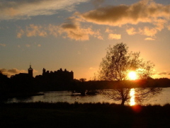 Linlithgow lies on the main route between Edinburgh and Stirling. The fact that today the M9, the Union Canal and the Edindurgh to Glasgow rail line all pass within a mile of the High Street is testament to the importance the location has along the lines of communication to the north and west. Linlithgow roughly translated from the Gaelic "Llaith Cau" meaning 'moist hollow' sits on the south side of a loch ('Lin') at the foot of the Riccarton Hills. A headland juts into the loch an provides an ideal site for a fortification which would control the passage of goods and people along the mainstreet. The first 'Pele' or fortlet was built in the early 13th Century by David I, however there is evidence that the Romans used the site as a way point for troops travelling up to the Antonine Wall. By the time of the Stewart Kings the buildings were used as a royal palace which became James IV favoured haunt out of the bustle of Edinburgh. However in 1526 the palace was being looked after by a caretaker staff and used as an arsenal, stables and armoury.
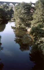 The approach to Linlithgow from the west was hampered by the River Avon that flows from its source at Fannyside Loch in North Lanarkshire, winds its way along the fast flowing and steep sided Avon gorge before making its way to the Firth of Forth at Grangemouth. The bridge 2 miles west of Linlithgow over the river was the first possible crossing point for carts and artillery up from its mouth. It is little wonder that James VI remarked of the brig that it was 'the maist necessyr brig standing upone ony watter within the realme’. Little remains on that old bridge. The new bridge built in the 1960's aligns to the modern road. A casual glance over the parapet on the upstream side in a drought will reveal the foundation stones of the old brig that would take the traveller up to Whitecross along the lane that runs beside the Brig Inn pub.
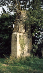 A mile further upstream nestled against the river's north west bank was Manuel Nunnery. Only the north portion of the west gable remains today, the rest being washed away by river management schemes in the 18th century, but the mill and associated farm are incorporated into the small cluster of buildings to the south. The Manuel house of Cistercian nuns was founded by Malcolm IV in 1164 and confirmed by William the Lion a few years later. Little is known about the order except that the house was not wealthy and the community was always a small one. The Nunnery was mentioned in the Rag roles of Edward III who recompensed the nuns for damage his army caused on its march to Perth in 1335 but more importantly James IV raised a petition in 1506 to have the convent closed as there were little more than five nuns and they appeared to lead a life remote from the Cistercian teachings. It was granted but appears never to have been enforced as records show that the prioress and four nuns were in residence in 1552, obviously none the worst for their involvement in the battle.
More importantly for Lennox, the nunnery maintained a ford that allowed access to the east bank, up onto the bluffs that overlooked the river and onto the Linlithgow to Torphichen road. This road and that leading out of town to the bridge met at the Westport.
Both of these roads and the river were overlooked by a small hill known to day as Peace Hill or more historically Pace Hill. The crest of the hill is now somewhat cropped to allow the trains access onto the impressive victorain viaduct that spans the river. At the base of the viaduct sit the Burgh mills, some of the oldest buildings still standing in Linlithgow Bridge but not thought to date back to 1526. In fact there is little evidence for any buildings being present at the time of the battle.
Care must be taken when assuming the course of the modern river is that faced by Lennox. In fact much of the landscape has been changed during the industrial revolution and in the 20th century due to mill workings and quarrying. Mill runs and quarry workings criss cross the site and the course of the river has been altered. However it can still be assumed that the river valley gets narrower the closer you get to the foot of Pace Hill which in itself overlooks the whole battlefield.
Modern Geographical and Cartographic Evidence
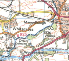 The most obvious evidence to the location of the battlefield site is the crossed swords on the Ordnance Survey map which places the action in the middle of the quarry site at the foot of Pace Hill. However such evidence can be deceptive as battles are fought across wider areas than those confined by a symbol on a map. Earlier OS maps depict the battlefield spreading along the south east banks of the Avon right up to the bridge and beyond, suggesting the surveyors had received anecdotal evidence of fighting all the way up the river valley.
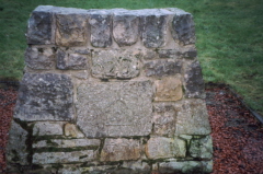
The Lennox Cairn, currently sited at the entrance to the Kettlestoun Housing estate is the only memorial to the action. The cairn itself has been relocated in its past to its current site from a location some 200yds to the north east. This reputedly marked the site where Lennox was murdered by James Hamilton of Finnart and its position would suggest this could be feasible.
So from the 'Brig', the Nunnery and the 'Cairn' we can inscribe a triangle, one side of which runs along the Avon, another along the Torphichen Road and at the centre of which is Pace Hill. It is around this area that we can place our forces.
Looking further a field there are a number of more modern reminders of the battle. Many of the roads in the local housing estates are named after the key protagonists in the fighting. In addition legend has it that the property on Linlithgow Bridge High Street named Borestane House has in its back garden the stone where Douglas was said to have raised his banner at the battle. Again tantalising evidence of a forgotten battle site.

